


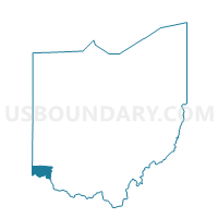
Voting District SYCAMORE I, Hamilton County, Ohio
About
Outline

Summary
| Unique Area Identifier | 646974 |
| Name | Voting District SYCAMORE I |
| County | Hamilton County |
| State | Ohio |
| Area (square miles) | 0.75 |
| Land Area (square miles) | 0.75 |
| Water Area (square miles) | 0.00 |
| % of Land Area | 99.65 |
| % of Water Area | 0.35 |
| Latitude of the Internal Point | 39.28393830 |
| Longtitude of the Internal Point | -84.34003090 |
Maps


Graphs
Select a template below for downloading or customizing gragh for Voting District SYCAMORE I, Hamilton County, Ohio


Neighbors
Neighoring Voting District (by Name) Neighboring Voting District on the Map
- 0087 DEF-T-W Voting District, Warren County, OH
- 0121 DEF-T-SWB Voting District, Warren County, OH
- Voting District SHARONVILLE 2-B, Hamilton County, OH
- Voting District SYCAMORE B, Hamilton County, OH
- Voting District SYCAMORE C, Hamilton County, OH
- Voting District SYCAMORE D, Hamilton County, OH
- Voting District SYMMES H, Hamilton County, OH
- Voting District SYMMES I, Hamilton County, OH
Top 10 Neighboring County Subdivision (by Population) Neighboring County Subdivision on the Map
- Deerfield township, Warren County, OH (36,059)
- Sycamore township, Hamilton County, OH (19,200)
- Symmes township, Hamilton County, OH (14,683)
- Sharonville city, Hamilton County, OH (11,197)
Top 10 Neighboring Place (by Population) Neighboring Place on the Map
- Sharonville city, OH (13,560)
- Sixteen Mile Stand CDP, OH (2,928)
- Highpoint CDP, OH (1,503)
- Brecon CDP, OH (244)
Top 10 Neighboring Unified School District (by Population) Neighboring Unified School District on the Map
- Mason City School District, OH (48,732)
- Princeton City School District, OH (42,620)
- Sycamore Community City School District, OH (33,620)
Top 10 Neighboring State Legislative District Lower Chamber (by Population) Neighboring State Legislative District Lower Chamber on the Map
- State House District 67, OH (143,439)
- State House District 35, OH (128,703)
- State House District 28, OH (109,005)
Top 10 Neighboring State Legislative District Upper Chamber (by Population) Neighboring State Legislative District Upper Chamber on the Map
Top 10 Neighboring 111th Congressional District (by Population) Neighboring 111th Congressional District on the Map
Top 10 Neighboring Census Tract (by Population) Neighboring Census Tract on the Map
- Census Tract 320.05, Warren County, OH (9,434)
- Census Tract 320.04, Warren County, OH (6,229)
- Census Tract 223.02, Hamilton County, OH (5,493)
- Census Tract 243.01, Hamilton County, OH (3,851)